
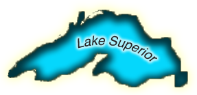
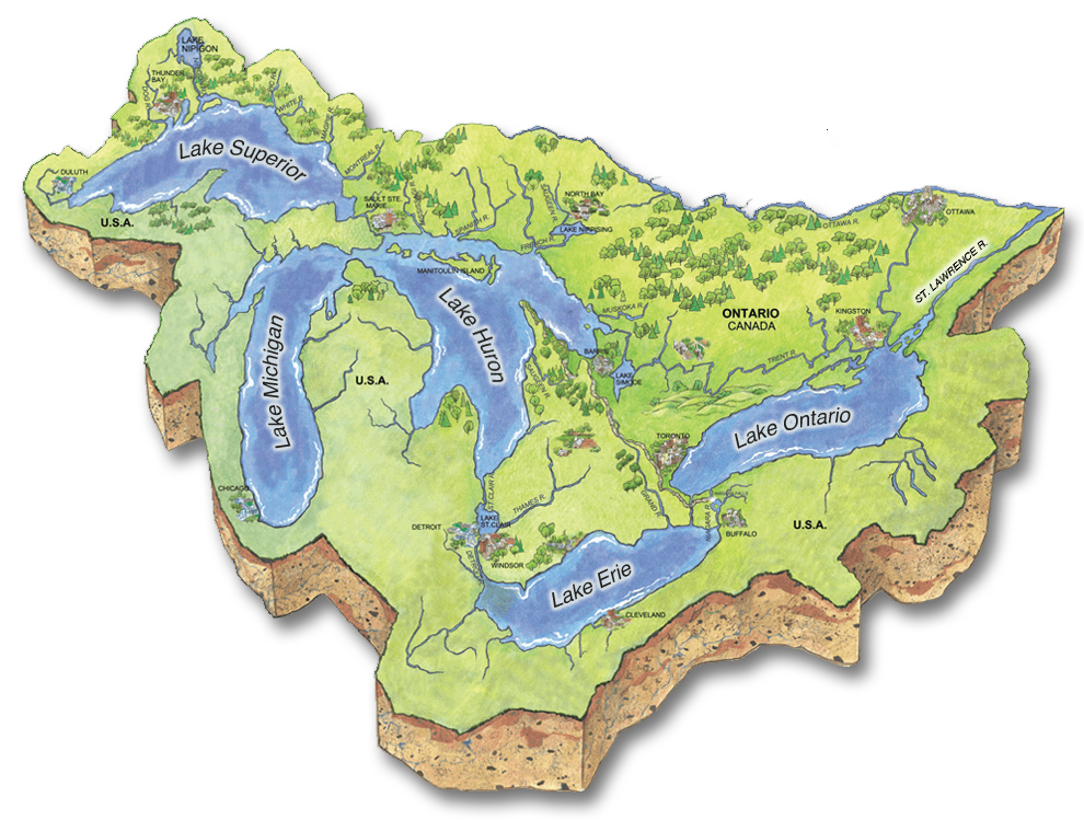
Lake Superior
Lake Superior may be considered to be the "Greatest" of the Great Lakes and it contains more water than all the other Great Lakes combined. It is also the deepest Great Lake and has the coldest water temperature which is on the average, only 4°C. Some of the world's oldest rocks, about 2.7 billion years old, can be found on the Ontario Shores of the lake.
Almost one million people in both Canada and the United States live in the Lake Superior watershed yet is it considered to be sparsely populated. This helped keep over 90% of land in the watershed covered by forest. The extensive forest cover supports the main industries in the watershed: forestry, mining and recreation. The natural forest cover in the watershed maintains the high water quality found in Lake Superior and it is considered the cleanest Great Lake. Like all the Great Lakes, Lake Superior is threatened by climate change and invasive species.
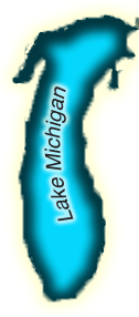
Lake Michigan
Contained entirely within the borders of the United States, Lake Michigan is the only Great Lake not shared by Canada and the United States. Over 12 million Americans live in the Lake Michigan watershed, making it the most populated of any Great Lake watershed. Most people live in the southern portion of the lake, where industry and agriculture are the primary industries. Natural resource sectors and tourism dominate the economy in the Northern half of the lake, which is sparsely populated. Tourism draws in millions of people annually, who come to visit the beaches of Lake Michigan, which include the world's largest freshwater dune system.
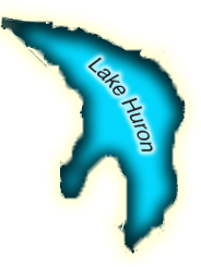
Lake Huron
Lake Huron is the second largest Great Lake. The Lake contains more than 30,000 islands. Including the shoreline of its islands, Lake Huron has the largest shoreline length of all the Great Lakes.
It is the only Great Lake that lacks a major city centre on its shores, and approximately 2.5 million Canadians and Americans call the watershed home. Residents in the watershed are dependent on natural resource sectors and tourism to support a strong economy. The world's largest freshwater island, Manitoulin Island, and longest freshwater beach, Wasaga, attract thousands of tourists and cottagers each summer. Lake Huron is threatened by climate change, changing water levels and invasive species.
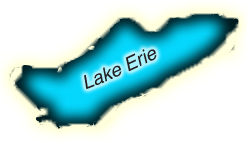
Lake Erie
Lake Erie is the smallest, shallowest and most southern Great Lake. These factors contribute to making it the warmest of the lakes, where summer water temperatures can reach as high as 27°C. The ecosystem of Lake Erie is extremely complex and includes a greater diversity of plants and animals than the other Great Lakes. With a fish population of 46 million, the warm waters of Lake Erie support more fish than any other Great Lake and sustain the world's most productive walleye fishery. The climate and fertile soil surrounding Lake Erie support a strong agricultural industry but manufacturing and shipping are also important for the local economy. Due to intensive agriculture and human development, the watershed has the least amount of natural plant cover of all the Great Lakes. Urban and industrial pollution, eutrophication, climate change, and invasive species all threaten the biodiversity and complexity of the Lake Erie ecosystem. Only about 21% of the land that drains into Lake Erie is covered by forest, making it the least forested watershed of the Great Lakes.
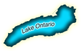
Lake Ontario
The Lake Ontario watershed is home to over 7.5 million Ontarians, more than any other Great Lake. While Lake Ontario has a slightly smaller surface area than Lake Erie, it is much deeper and therefore contains more water at cooler temperatures than Lake Erie. Agriculture, manufacturing, and shipping are the base for the economy and major economic centres such as Toronto and Hamilton are found on the shores of Lake Ontario. As the last Great Lake before the St. Lawrence River, all the Great Lakes drain through Lake Ontario and it is negatively impacted by the pollution originating in the other lakes. Additionally, the large population base and associated development along Lake Ontario shores threaten to decrease water quality, nearshore habitats and biodiversity in the lake.
Water enters Lake Ontario from Lake Erie through the Niagara River. Lake Ontario is about 100 meters lower in elevation than Lake Erie, and this difference helps to produce Niagara Falls.
80% of the water in Lake Ontario comes from the other Great Lakes, while about 14% comes from other rivers and streams that flow in the Lake. The remaining water is contributed to Lake Ontario from rain and snowfall.
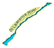
The St. Lawrence River
The St. Lawrence is Canada's third longest river. The St. Lawrence system has been changed significantly from its natural state. It has been dredged and diverted in order to form the St. Lawrence Seaway, one of the world's busiest shipping corridors and commercial waterways and it has been dammed to produce hydroelectricity. The St. Lawrence River links the Atlantic Ocean with the Great Lakes and supports a population of about 30 million Americans and 15 million Canadians. It includes lakes and channels, a long estuary, and a gulf. The area is home to richly diverse habitats and many species of fish, birds, and wildlife. Stressors on the St. Lawrence are similar to those of the Great Lakes threatening water quality, biodiversity and wetlands.
Actions We Can Do To Protect The Great Lakes
We impact conditions in the Great Lakes and St. Lawrence River by using the best science, knowing the issues, and targeting our actions in partnership with all levels of government, agencies, community groups, and individual landowners and residents.
Prevent Spread of Invasive Species
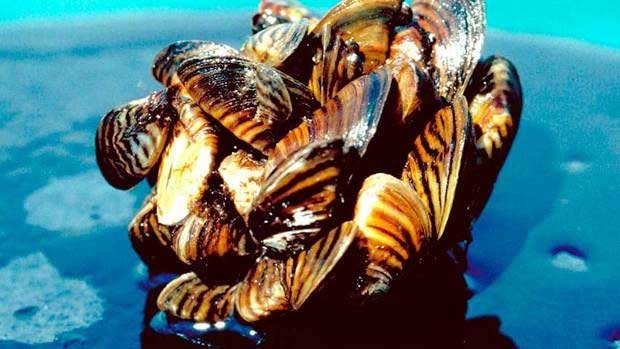
Invasive species such as canary reed grass (Phragmites), purple loosestrife and zebra mussels are some of the greatest threats to native plants, animals and ecosystems in the Great Lakes and St. Lawrence River. Both U.S and Canadian governments regulate shipping practices to prevent aquatic invasive species from being transported into the Great Lakes. Government agencies monitor invasive species, supporting and delivering programs that address aquatic invasive species at specific locations in the Great Lakes, along the shorelines and in watersheds. Boaters and fisherman can prevent unintentionally spreading aquatic invasive species by removing visible debris, plants or animals from equipment and draining the bilge, live well, or motor on boats when leaving a lake. To stop new invasive species from being introduced, never release turtles, frogs, or plants from aquariums into the natural environment. You can often return them to pet or aquarium stores or trade them online.
Do you want to learn more about invasive species?
More Research
Watershed-based analysis and modeling, that link water quantity to quality are critical tools to assess and establish priority watershed actions to benefit the Great Lakes nearshore area. The nearshore area is an essential contributor to the social, economic and environmental health of the Great Lakes-St. Lawrence River basin. Understanding nearshore processes and the aquatic shoreline ecosystems is an important aspect of successful watershed and shoreline action implementation. More research is also needed to increase our understanding of the implications of climate change to enable adaptation within watersheds and along Great Lakes shorelines.
Target Actions
Using the best science, measurable targets for nearshore areas should be set in order to achieve Great Lakes objectives. This requires:
- Understanding the relationship between watersheds/shorelines and the nearshore
- Targeting watershed and shoreline restoration actions with the greatest nearshore benefits
- Adapting to climate change
- Monitoring and reporting to track progress
- Sharing knowledge and information between practitioners and the public
Link to Integrated Management Approach to Great Lakes Protection PDF.
Conserve Water
We need water every day and although water seems abundant in the Great Lakes and St. Lawrence River, we do not have an infinite amount of water available. Rain, snow and groundwater only replace about 1% of the total water in the Great Lakes – St. Lawrence River each year. Therefore, if people use more than 1% of the total water in the Great Lakes – St. Lawrence River the amount of water in the Lakes and River will decrease. Additionally, climate change is expected to decrease the amount of water in the Lakes.
Communities can manage their water use through water budgeting and watershed planning. Individual people can make a difference as well by using water efficient appliances, toilets, and taps; repairing leaks, cutting down on how much water is used in the home and in yards, as well as rainwater harvesting. A lot of little actions can add up!
Integrated Watershed Management
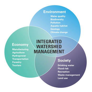
Using an integrated watershed management (IWM) approach, all community interests work together to identify what issues and actions are impacting the watershed's resources, and then map out different strategies and plans to address those issues. These plans and strategies are implemented, monitored, reported on, and updated on a regular basis in order to adapt to changing land uses, new or increasing stressors, new information, or different management approaches. To be successful, IWM requires collaborations and involvement of a wide variety of community interests and water users including municipalities, businesses, residents, agencies and landowners. They decide on the priority issues that need to be addressed, help to set goals, decide on what actions to take and implement locally.
Do you want to learn more about Integrated Watershed Management
Monitor
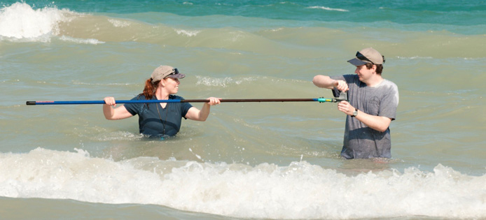
Monitoring conditions in the Great Lakes and St. Lawrence River, their watersheds, and particularly the nearshore areas of the Great Lakes and St. Lawrence River helps to identify problems early and target actions to address problems and issues. Monitoring also helps to feed into larger watershed plans. Monitoring streams and rivers that feed directly into the Great Lakes and St. Lawrence River helps to target and address nutrient loadings. Conservation Authorities participate in various monitoring programs and networks in partnership with others, including the Ontario Ministry of the Environment. Citizen scientists play an important role as well through community monitoring programs such as Adopt-a-Pond, FrogWatch, Christmas Bird Counts, and the Marsh Monitoring Program.
Do you want to learn more about how Conservation Authorities monitor watersheds?
Source Protection Plans
Ontario’s Clean Water Act requires communities to have watershed-based drinking water source protection plans founded on sound science in order to effectively protect their drinking water sources. The Great Lakes and St. Lawrence River act as a drinking water source for 80% of Ontario residents. Source protection plans protect well heads that tap into underground and river or lake sources plus Great Lake / St. Lawrence River intake zones which are areas where we draw our water from. Protecting these sources prevents both contamination and overuse of water resources. To find out more information about your source protection plan, visit Conservation Ontario’s website: http://www.conservationontario.ca/uncategorised/139-source-protection-faqs
Do you want to learn more about Source Water Protection
Agricultural Best Management Practices
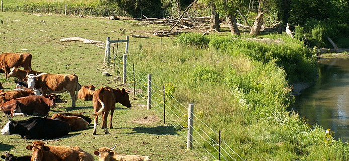
Agricultural best management practices (BMPs) are methods that can be used by farmers to conserve and protect soil and water resources while maintaining or increasing production. BMPs such as windbreaks, buffer strips, proper manure storage, woodlot management, habitat restoration, erosion prevention, fencing of livestock and shelterbelt planting protect and improve the water quality of streams and rivers that empty into the Great Lakes and St. Lawrence River. Other tools include nutrient management plans, pest management plans and environmental farm plans. Contact your local Conservation Authority for information on the availability of incentives and advice.
Protect Biodiversity & Habitats
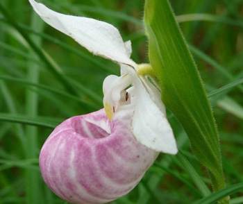
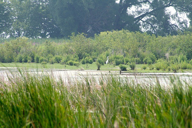
The Great Lakes and St. Lawrence River area contains a rich mix of habitats, species, and ecosystems including birds, bats and migratory native fish, coastal wetlands, nearshore area, dynamic and cobble beaches, sand dunes, alvars and coastal forests, rivers, islands, estuaries and connecting channels. We rely on healthy biodiversity for healthy communities, a vibrant economy, and most of all, for our own well being. All levels of government work collaboratively with local agencies, citizen groups, municipalities, and landowners on both sides of the Great Lakes to develop strategies and provide incentives to protect, restore and manage issues and concerns around Great Lakes biodiversity. A lot of little actions can add up to a big impact.
Protect Wetlands & Shorelines
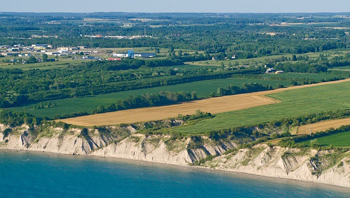
Natural shorelines and wetlands help to protect water quality, prevent runoff, reduce the impacts of flooding and erosion, store water during drought, and provide healthy habitat for a wide variety of biodiversity. You can help nature do its job in preventing erosion by avoiding channelization and hardening the shoreline by leaving rocks and logs along the shoreline and keeping natural vegetation in place.
Wetlands are often lost to in-filling, changes to drainage patterns, sedimentation, vegetation removal and pollution. Protecting these important ecosystems is the first priority because of the difficulty in restoring wetlands or creating new ones. Restored wetlands lack the complex functions and diverse species of naturally occurring, healthy wetlands plus some study is usually needed to determine if present conditions will support a new wetland.
Preserve Natural Areas
Conservation areas, reserves and other natural lands help protect important water resources, provide green space and preserve Ontario’s natural heritage. Government and other agencies, such as Conservation Authorities, are active in land conservation and preservation activities and have programs and plans designed to protect, manage and restore shorelines, wetlands, forests, and other natural areas.
Citizens Pitch In
Citizens can help to protect the Great Lakes and St. Lawrence River by preventing the spread of invasive species, reducing polluted runoff from their properties, reduce the flow of toxic chemicals into the lakes and river, protect important habitats and species, and reduce how much water you use daily. Specific activities can include:
- Wash your power boat and trailer before putting it into a different body of water
- Drain your bait wells, bait buckets and other equipment onto land, not in the water
- Never release bait into the Great Lakes or St. Lawrence River
- Never release live fish or aquatic plants into the wild such as aquarium fish
- Prevent runoff and keep water on the land on your property by installing a rain barrel, building a rain garden, installing interlock pavers or flagstones for patios, and disconnect your downspouts (and direct away from your foundation)
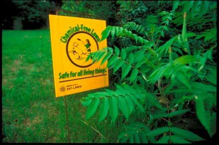
- Reduce or avoid the use of pesticides or fertilizers
- Make sure your septic system is up to date
- Avoid hardened shorelines and instead naturalize your shoreline
- Preserve wetlands and beaches
- Use non-toxic cleaners in your home
- Use local hazardous waste sites to dispose of paint, oil, solvents and other toxic products
- Do not use a burn barrel to dispose of trash; recycle and use a composter or green bin
- Use native plants for trees, shrubs and gardens
- Protect fish habitat
Low Impact Development

Low impact development (LID) are land use practices that reduce or stop the impacts of increased runoff and stormwater pollution. LID restores and maintains the natural flow of water within the water cycle as well as reduces the volume of water flowing after heavy rain or snowmelt. LID is most effective when implemented with a watershed scale understanding of how best to protect or restore the natural water balance. LID includes the use of innovative site design and the implementation of green infrastructure practices such as interlock pavement, rainwater harvesting, green roofs, downspout disconnection, grass swales, and native plantings. Using these practices keeps water on the land and filtering down to groundwater sources instead of flowing directly across paved surfaces to streams, rivers, and eventually the Great Lakes and St. Lawrence River.
Green Infastructure
Pollution from agricultural and urban runoff enters the Great Lakes via many different ways: discharges from sewage plants and industrial wastewater, runoff after heavy rains or snow melt, through air pollution and from groundwater sources. Green Infrastructure is both the interconnected network of natural areas including forests, wetlands, rivers, streams, and lakes; and natural technologies which help to promote water conservation, urban cooing, reduced emissions, resilient biodiversity and increased energy efficiency. Green Infrastructure is incorporated into Low Impact Development designs and approaches to prevent stormwater runoff and support a healthy water cycle.
← Back to Low Impact Development
Green Infrastructure
Pollution from agricultural and urban runoff enters the Great Lakes via many different ways: discharges from sewage plants and industrial wastewater, runoff after heavy rains or snow melt, through air pollution and from groundwater sources. Green Infrastructure is both the interconnected network of natural areas including forests, wetlands, rivers, streams, and lakes; and natural technologies which help to promote water conservation, urban cooing, reduced emissions, resilient biodiversity and increased energy efficiency. Green Infrastructure is incorporated into Low Impact Development designs and approaches to prevent stormwater runoff and support a healthy water cycle.
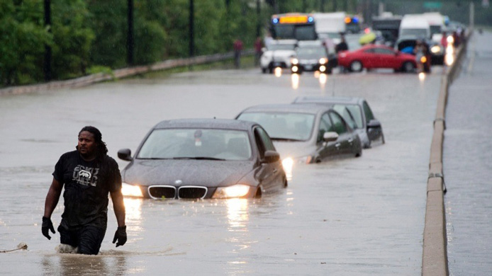
Prevent Stormwater Runoff
Contaminated runoff from agricultural lands or urban areas carries nutrients, sediments, oil and gas, pharmaceuticals, road salt, waste, and a wide variety of other contaminants. Paved surfaces provide a direct conduit for runoff to travel into streams, rivers, and groundwater, eventually to the Great Lakes and St. Lawrence River. Actions such as stormwater management planning, implementation of low impact development practices, and green infrastructure areas and technologies help to slow down the runoff, store it, and filter out many contaminants.
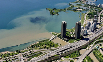
Protect Nearshore Areas
The nearshore of the Great Lakes and St. Lawrence River has a wide variety of diverse habitats for fish and wildlife and is significantly impacted by nutrients from rural and urban runoff. Actions that need to be taken to protect important nearshore areas include:
- Targeting specific remedial and preventative actions in the areas that contribute the most sediment, water and nutrient runoff
- Increasing the use of Green Infrastructure practices and technologies such as increasing natural cover using low impact development practices in urban areas that help to keep water on the land and reduce runoff
- Watershed planning / shoreline management plans
- Monitoring and reporting
- Collaborations among agencies, all levels of government, and residents
- Protecting and restoring wetlands
Visit The Great Lakes
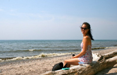
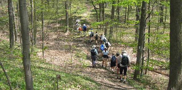
You can get to know the Great Lakes and St. Lawrence River by visiting them. Hiking or cycling a waterfront trail, visiting a beach, wetland or forest within shoreline conservation areas, provincial or national parks will give you first-hand experience of these important waters and everything that lives with them. Interpretive information is available at different locations or online often as podcasts or fact sheets.
Conservation Authorities offer lots of hiking opportunities along the shoreline or in watersheds. Visit Ontario's Conservation Areas
Prevent Pollution
Whether you live on a shoreline or further inland, runoff from your yard can make its way to the Great Lakes and St. Lawrence River through water treatment discharge or from streams and rivers and groundwater sources. Fertilizers, pesticides, road salt and animal waste can contaminate waterways and can impact the Great Lakes and St. Lawrence River which is an important source of drinking water for most Ontarians. Never discard unused medications, cooking oil or other household waste down your drain, into the toilet or into municipal sewer drains. Water treatment plants are designed primarily to treat human waste and do not have the technology to address many chemicals and pharmaceuticals.
Businesses can prevent pollution as well, by developing pollution prevention strategies. This involves implementing processes, practices, and the use of materials or products that minimize the creation of pollution and waste. "Pollution prevention?" reviews may also help identify strategies that businesses can use to reduce operating costs, liability and insurance rates, while improving safety, employee morale and public image. Contact your local municipality or Conservation Authority for information on the availability of technical and financial assistance to undertake a pollution prevention review.
Climate Change Adaptation Strategies
Climate change impacts Ontario's water resources and the effects are expected to escalate as we move into the future. Communities, Conservation Authorities, businesses, as well as provincial and federal governments are working to develop and implement climate change adaptation strategies that will address the impacts of climate change such as:
- threats to water quality and supply
- rising temperatures and changing precipitation patterns which create more drought conditions and more frequent severe weather
- more extreme rainfall which is leads increased flood and erosion problems
- lowered river flows and warmed surface waters
- depleted wetlands
- degraded biodiversity
Do you want to learn how Conservation Authorities protect us against flooding?
Maintain & Upgrade Septic Systems

Approximately 1 million homes in Ontario use septic systems to treat and dispose of sewage. The typical private system has two basic parts - a septic tank and a leading bed - both of which are buried underground. Old and deteriorating septic systems can leak human waste and other contaminants into nearby water bodies or into groundwater sources, possibly eventually draining to the Great Lakes and St. Lawrence River and impacting water quality and beaches and shorelines. Technical and financial assistance may be available for landowners to help identify problems and undertake repairs, upgrades or replacements. Contact your local Conservation Authority, municipality or other conservation organizations for information on the availability of incentives and advice.
Link to PDF: Septic Smart PDF