
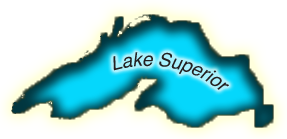
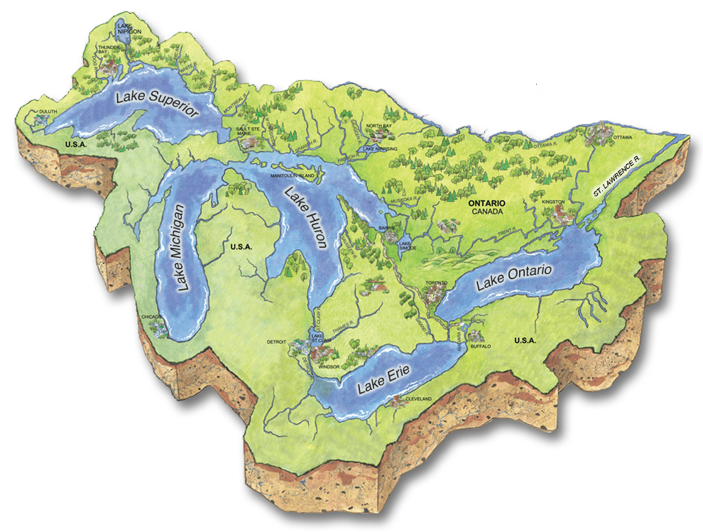
Lake Superior
Lake Superior may be considered to be the "Greatest" of the Great Lakes and it contains more water than all the other Great Lakes combined. It is also the deepest Great Lake and has the coldest water temperature which is on the average, only 4°C. Some of the world's oldest rocks, about 2.7 billion years old, can be found on the Ontario Shores of the lake.
Almost one million people in both Canada and the United States live in the Lake Superior watershed yet is it considered to be sparsely populated. This helped keep over 90% of land in the watershed covered by forest. The extensive forest cover supports the main industries in the watershed: forestry, mining and recreation. The natural forest cover in the watershed maintains the high water quality found in Lake Superior and it is considered the cleanest Great Lake. Like all the Great Lakes, Lake Superior is threatened by climate change and invasive species.
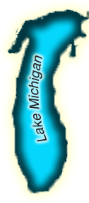
Lake Michigan
Contained entirely within the borders of the United States, Lake Michigan is the only Great Lake not shared by Canada and the United States. Over 12 million Americans live in the Lake Michigan watershed, making it the most populated of any Great Lake watershed. Most people live in the southern portion of the lake, where industry and agriculture are the primary industries. Natural resource sectors and tourism dominate the economy in the Northern half of the lake, which is sparsely populated. Tourism draws in millions of people annually, who come to visit the beaches of Lake Michigan, which include the world's largest freshwater dune system.
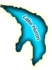
Lake Huron
Lake Huron is the second largest Great Lake. The Lake contains more than 30,000 islands. Including the shoreline of its islands, Lake Huron has the largest shoreline length of all the Great Lakes.
It is the only Great Lake that lacks a major city centre on its shores, and approximately 2.5 million Canadians and Americans call the watershed home. Residents in the watershed are dependent on natural resource sectors and tourism to support a strong economy. The world's largest freshwater island, Manitoulin Island, and longest freshwater beach, Wasaga, attract thousands of tourists and cottagers each summer. Lake Huron is threatened by climate change, changing water levels and invasive species.
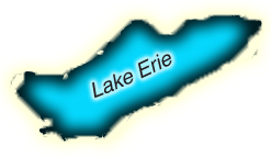
Lake Erie
Lake Erie is the smallest, shallowest and most southern Great Lake. These factors contribute to making it the warmest of the lakes, where summer water temperatures can reach as high as 27°C. The ecosystem of Lake Erie is extremely complex and includes a greater diversity of plants and animals than the other Great Lakes. With a fish population of 46 million, the warm waters of Lake Erie support more fish than any other Great Lake and sustain the world's most productive walleye fishery. The climate and fertile soil surrounding Lake Erie support a strong agricultural industry but manufacturing and shipping are also important for the local economy. Due to intensive agriculture and human development, the watershed has the least amount of natural plant cover of all the Great Lakes. Urban and industrial pollution, eutrophication, climate change, and invasive species all threaten the biodiversity and complexity of the Lake Erie ecosystem. Only about 21% of the land that drains into Lake Erie is covered by forest, making it the least forested watershed of the Great Lakes.
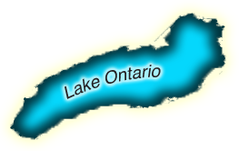
Lake Ontario
The Lake Ontario watershed is home to over 7.5 million Ontarians, more than any other Great Lake. While Lake Ontario has a slightly smaller surface area than Lake Erie, it is much deeper and therefore contains more water at cooler temperatures than Lake Erie. Agriculture, manufacturing, and shipping are the base for the economy and major economic centres such as Toronto and Hamilton are found on the shores of Lake Ontario. As the last Great Lake before the St. Lawrence River, all the Great Lakes drain through Lake Ontario and it is negatively impacted by the pollution originating in the other lakes. Additionally, the large population base and associated development along Lake Ontario shores threaten to decrease water quality, nearshore habitats and biodiversity in the lake.
Water enters Lake Ontario from Lake Erie through the Niagara River. Lake Ontario is about 100 meters lower in elevation than Lake Erie, and this difference helps to produce Niagara Falls.
80% of the water in Lake Ontario comes from the other Great Lakes, while about 14% comes from other rivers and streams that flow in the Lake. The remaining water is contributed to Lake Ontario from rain and snowfall.
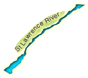
The St. Lawrence River
The St. Lawrence is Canada's third longest river. The St. Lawrence system has been changed significantly from its natural state. It has been dredged and diverted in order to form the St. Lawrence Seaway, one of the world's busiest shipping corridors and commercial waterways and it has been dammed to produce hydroelectricity. The St. Lawrence River links the Atlantic Ocean with the Great Lakes and supports a population of about 30 million Americans and 15 million Canadians. It includes lakes and channels, a long estuary, and a gulf. The area is home to richly diverse habitats and many species of fish, birds, and wildlife. Stressors on the St. Lawrence are similar to those of the Great Lakes threatening water quality, biodiversity and wetlands.
Get To Know Your Great Lakes & St. Lawrence River - It's in Your Backyard
The Great Lakes and St. Lawrence River and their watersheds are made up of forests, wetlands, water sources, plants and animals, and provide multiple ecological goods and services that drive Ontario's economy and contribute to a healthy environment and provide great places for people to live and work. Every day, we rely on their ecosystem goods and services - they connect us to our environment.
This interactive map provides you with an opportunity to explore the benefits of the Great Lakes and St. Lawrence River, the stressors facing them today, and actions we can take to protect them.
Perhaps it will inspire you to visit one of many trails and natural areas along the shorelines of our Great Lakes or the St. Lawrence River. Afterall, it's right in your backyard.
Rivers, Streams & Inland Lakes
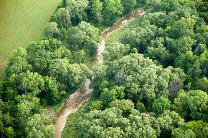
All of the inland lakes, rivers and streams in the Great Lakes and St. Lawrence Basin eventually empty water into the Great Lakes or St. Lawrence River. This includes large bodies of water – such as Lakes Nipigon and Simcoe – down to the smallest creek running through your backyard.
We depend on rivers and lakes for sources of drinking water and places to recreate.
Many of Ontario's rivers support unique species of fish and wildlife, such as the eastern sand darter, a minnow that is only found in Great Lakes rivers, and a food source for larger fish species. Because of their historical, natural and cultural significance nine rivers in the Great Lakes-St. Lawrence River Basin have been designated as Canadian Heritage Rivers.
Rivers, inland lakes and streams are all part of the "watershed connection" that link our land to the Great Lakes and St. Lawrence River. Activities we do on the land upstream in watersheds can impact inland lakes and rivers that eventually flow downstream to the Great Lakes or St. Lawrence River.
Upstream | Downstream
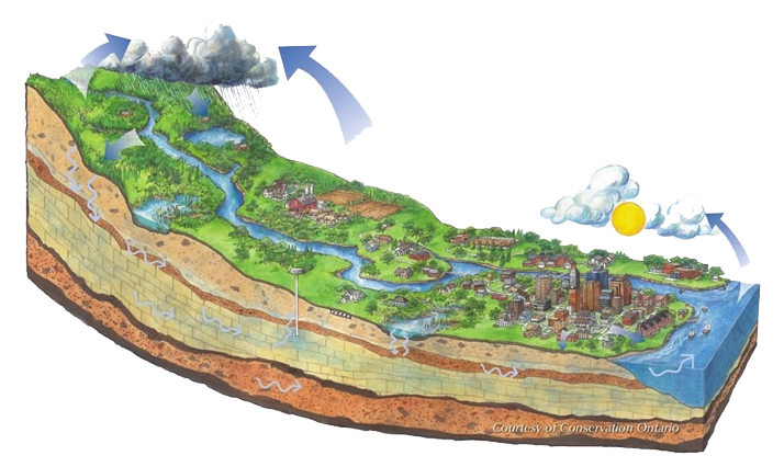
We do not have an endless supply of water in our world - the water we have now is the same water enjoyed by dinosaurs before we evolved. What we do in the Great Lakes and St. Lawrence River watersheds upstream can directly impact water and other conditions downstream. From the moment a drop of rain falls to the ground, it either evaporates back up to the atmosphere or moves over and under different landscapes, across family backyards, and through communities eventually making its way to a body of water, such as a pond, river or lake. Along the way it is affected by natural processes and conditions, and especially by what we do on the land. Eventually, the drop of water will likely make it way to the Great Lakes or St. Lawrence River.
In this region, water moves from Lake Superior through Lakes Huron, Erie, Ontario and then into the Atlantic Ocean via the St. Lawrence River. Because of the way water moves through the Great Lakes, Lakes Superior, Huron and Michigan are often referred to as the Upper Great Lakes. Lakes Erie and Ontario are thought of as the Lower Great Lakes. Water from rivers, streams and inland lakes in most of Ontario flows into the Great Lakes and the St. Lawrence River, and as a result, what we do upstream impacts water resources in our Great Lakes and St. Lawrence River.
Do you want to see how our water cycle works? You can watch how water flows across the land and through groundwater sources from upstream to downstream in the Water Cycle.
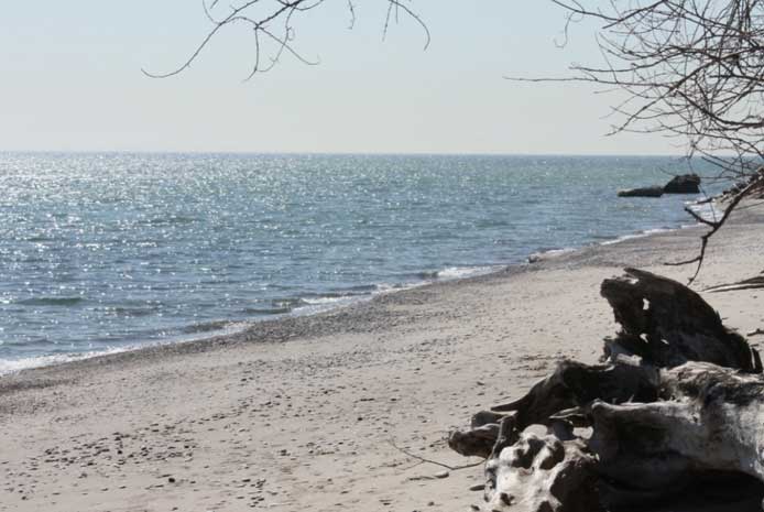
Shorelines
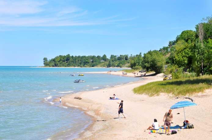
The Great Lakes and St. Lawrence River shorelines are areas which are always undergoing changes as a result of wind, waves and currents. There is constant movement including the removal and deposit of sand, pebbles and cobbles in the shallow waters. Exposure to wind, currents, waves, flooding, groundwater, surface runoff, and moving ice contribute to this change. Healthy shorelines help to moderate storms and pollution as well as ensure healthy water quality and healthy fish and wildlife. Shorelines provide people with opportunities for recreational activities such as swimming, picnicking, hiking and boating, and contribute to higher property values.
Source: 2013 Southern Georgian Bay Shoreline Stewardship Guide, Lake Huron Centre for Coastal Conservation
Watershed Connections
A watershed is an area of land where all the water drains into the same water body.
Watersheds come in many shapes and sizes and support a wide variety of biodiversity (plants, animals, wetlands, rivers, lakes, streams, birds and much more). A small watershed may drain into a small creek or river, and a large watershed may drain into a lake or the ocean. Think of your local creek, river or stream. Where does it start? What types of landscapes does it pass through? Where does the water end up? All of the area covered is a watershed.
In addition to our many farms, towns, and cities, a watershed is made up of a unique mixture of habitats including wetlands, forests, creeks, rivers and lakes. Everything is connected in a watershed so what you do in one part of the watershed can affect another part of the watershed.
If you live in Ontario, you likely live in the Great Lakes and St. Lawrence River watershed. This means that a drop of water that falls in your backyard, on your driveway, or in your local park flows through your local creek or river and eventually finds its way to the Great Lakes or St. Lawrence River. These water bodies are an important resource for all Ontarians. Over 11 million of us rely on the Great Lakes for clean drinking water. Our agricultural and manufacturing sectors depend on them to help ensure our economic prosperity. By protecting your local creek, river, wetland or inland lake you can help ensure the Great Lakes and St. Lawrence River are healthy for your children and future generations.
Learn more about how everything is connected in a watershed and the important features that help make up a healthy Great Lakes and St. Lawrence River.
Do you want to watch an animated watershed?
Do you want to learn more about watersheds - Watersheds 101
A number of Conservation Authorities have produced watershed report cards. Do you want to find out if your watershed has one? Visit Watershed Checkup
Sand Dunes
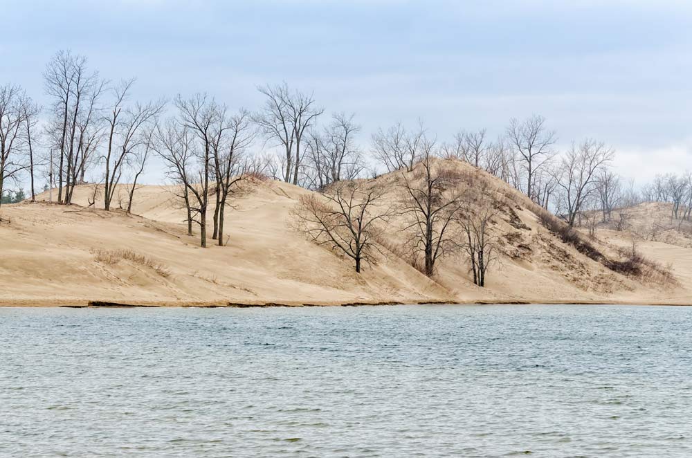
Sand dune systems are a rare and vulnerable coastal feature only found along 1.5% of Ontario's Great Lakes coastline. These rare gems are also places with high quality beaches that are attractive locations for beach goers.
The sand is the result of millions of years of erosion by wind, waves, water and ice on the granite and quartz rocks in the region. These rocks were worn down, and then deposited by the lakes, and the wind, along the shorelines of the lakes. Because they are influenced by the ongoing forces of wind and water, their structure is constantly changing.
Sand dunes act as a natural barrier against storms and waves, protecting inland biodiversity, houses and cottages. They are also home to many plants, trees, shrubs, birds, and animals.
Dune vegetation hold dunes in place. They are very susceptible to storm damage, erosion, and human activities such as building and dredging. There is no natural recovery for dunes.
Forests
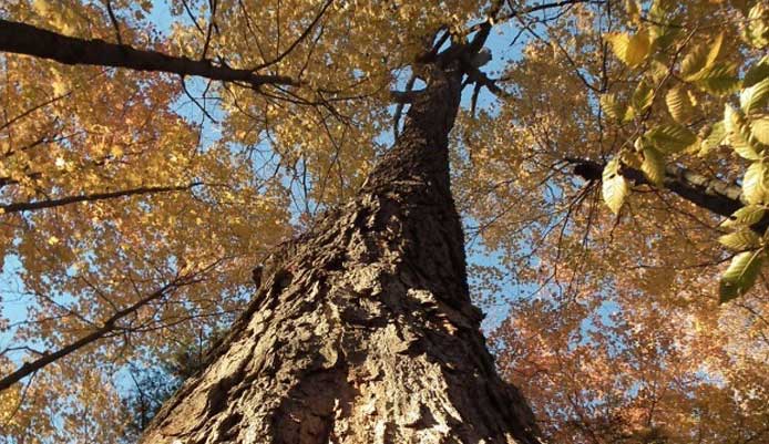
Forests clean our air, filter and store water, prevent erosion, absorb carbon dioxide, provide oxygen, and provide habitat for wildlife.
More than half of the land in the Great Lakes-St. Lawrence River basin is covered by forests. In Canada, 10% of these forests are protected.
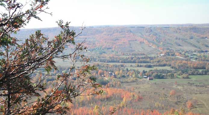
There are many types of forests in the Great Lakes and St. Lawrence River watersheds. In the Northern region, forests are dominated by evergreen trees. As you move South towards Lake Erie, the makeup of forests changes and they become dominated by deciduous trees that lose their leaves in the winter. The Carolinian Forest, a type of deciduous forest, extends from Windsor to Toronto, and is the only forest type in Canada that supports Kentucky Coffee and Sassafras trees – these species are not found anywhere else in Canada. The climate of this area is moderated by the nearby Great Lakes and as a result, supports animal and plant species usually not found in other parts of Canada.
Niagara Escarpment
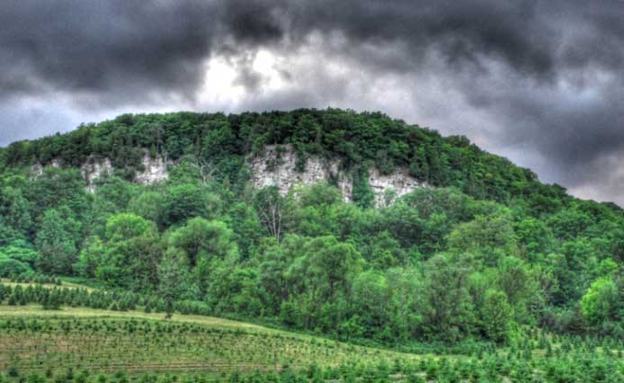
The Niagara Escarpment is a ridge made up of layers of rock; one side of the ridge has a steep cliff, while the other side of the ridge has a gradual slope.
Created by geological processes more than 450 million years ago, the entire escarpment is the shape of an arc running from New York, through Ontario and Lake Huron, into Michigan and Wisconsin. In Ontario alone, the escarpment stretches a total of 725 km from Queenston, south of Lake Ontario, up through Tobermory on the shores of Lake Huron.
The escarpment is very important because it supports a diverse number of habitats, including wetlands, streams and forests that contain over 1500 plant species, and over 400 wildlife species making it one of the most diverse landscapes in Ontario. Over 60 waterfalls, including Niagara Falls, are found on the escarpment. The water that creates the falls eventually flows into the Great Lakes, linking this important landscape to our Great Lakes and St. Lawrence River.
The Niagara Escarpment has been designated by the United Nations Educational, Scientific and Cultural Organization as a World Biosphere Reserve.
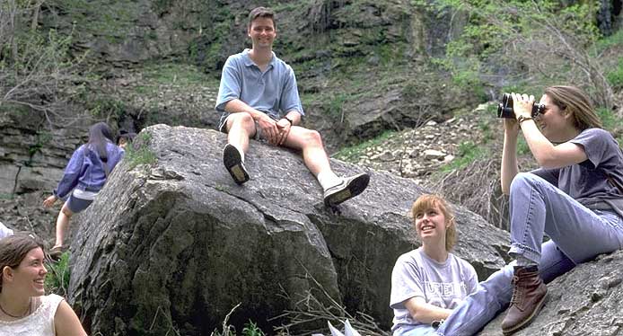
This region also offers numerous recreational activities such as hiking, camping, and snowshoeing. The Bruce Trail is a popular hiking trail in addition to the many trails offered within Conservation Areas.
Plant Life
A wide variety of plants, shrubs and trees grow on the edges of the Great Lakes and St. Lawrence River as well as inland, within the watershed. Vegetation helps to filter pollution from water and air, reduces soil erosion, and provides habitat for wildlife.
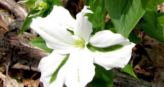
Plants that survive completely or partly covered in water, or aquatic plants, are common in Great Lakes and St. Lawrence coastal wetlands and nearshore areas. These plants are an important food source and provide habitat for a variety of animals, in particular fish. A number of plants are unique to these shorelines and are not found anywhere else on our planet. Pitcher's Thistle, Lakeside Daisy, and Dwarf Lake Iris are all examples of plants which are only found here and depend on the unique habitats provided by the coasts and wetlands of the Great Lakes.
Tall grass prairie, oak plains, and woodlands are common plant communities in the Great Lakes-St. Lawrence River watershed. Together, these different communities help support more than 2,000 different plant species found in Ontario.
The diversity of native plants in this area is supported by the large range in temperatures and rainfall in Ontario, from the colder drier Northern regions on the shores of Lake Superior to the wetter warmer Southern region along the coast of Lake Erie.
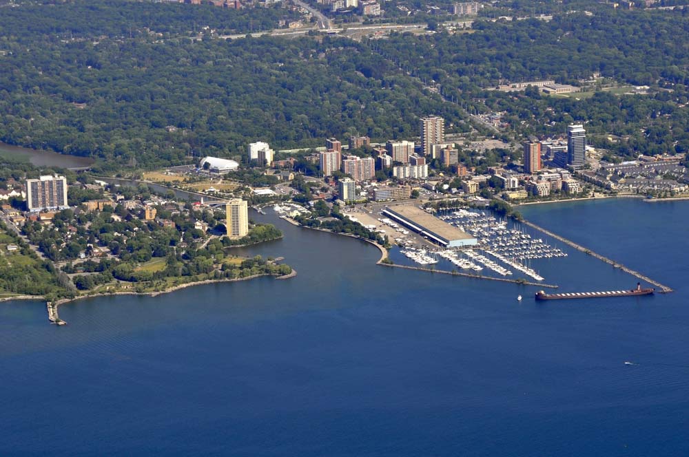
People
Ontario is home to a large population of more than 13.5 million which is projected to grow by 29% to just over 17 million by 2036. More than 85% of people live in urban centres, largely in cities on the shores of the Great Lakes. Most people live along the western shore of Lake Ontario, including the Greater Toronto Area, Hamilton, St. Catharines and Niagara Falls. This area is one of the fastest growing areas in North America.
People have lived in Ontario for more than 12,000 years. The first people were Algonquin and Iroquoian First Nations people, followed by European immigrants. Today, Toronto is one of the most multi-cultured cities in the world. More than 200 ethnic origins were reported by people living in Ontario in 2011. The median age of Ontarians is about 40 years.
Source: Government of Ontario
Wetlands
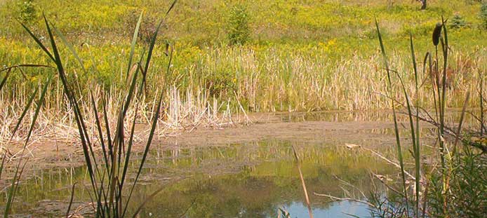
Wetlands are lands that are seasonally or permanently covered by shallow water, or land where the water table is close to or at the surface. All wetlands provide very important benefits to us, contributing to both a healthy environment and vibrant Ontario economy. They are also special places for people to visit to view birds, animals and other wildlife. Ontario has lost over 90% of its original wetlands.
Wetlands thrive and depend on changing water levels and moisture conditions. Some wetlands are covered with water year round, while others flood seasonally. Depending on the source of water, very different types of wetlands develop.
In Ontario there are four basic wetland types: swamps, bogs, fens and marshes. Wetlands may occur along the shores of rivers or lakes, have permanent or seasonal streams flowing in or out, or may be completely isolated. As well, there are Great Lakes coastal wetlands.
Do you want to learn more about wetlands? Visit: Wetlands - Workhorses of Our Watersheds to learn about the characteristics of wetlands, how wetlands work, and what we're doing to protect them.
Floodplains
Floodplains are designated zones beside watercourses that serve as natural filters and buffers, protecting nearby people and property from flood damage. These areas flood when the water level reaches a flood stage. Floodplains can change over time, depending on conditions of watercourses.
Over the years, floodplain managers have become more aware of the benefits of protecting floodplains.
Ontario's Conservation Authorities regulate development in floodplains in order to protect people and property from flooding.
Did you want to learn more about how Conservation Authorities regulate activities?
Living Great Lakes
A variety of mammals, birds, waterfowl, reptiles, amphibians, insects and invertebrates can all be found in the Great Lakes and St. Lawrence River ecosystem.
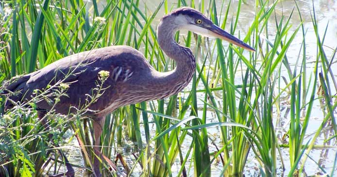
We commonly associate certain animals with the waters of the Great Lakes or St. Lawrence River region - animals like the beaver, moose, frogs, turtles and ducks. But many animals that we do not necessarily associate with this region rely on them more than we realize. For example, small mammals such as moles use the lush vegetation at the edge of the Great Lakes coastal wetlands for cover and as a source of food. In turn, they provide food for other mammals and birds. Hundreds of species of birds and waterfowl depend on the Great Lakes and St. Lawrence River during migration as an important rest stop, with plenty of food and shelter, during their long journey. Many insects use the waters to complete at least a portion of their lifecycle. Mayflies, for example, lay their eggs in the Great Lakes and St. Lawrence River, where their young hatch and grow in the mud that covers the lake bottom. These young mayflies act as an important source of food for fish, and are only found where water is in healthy condition. Ensuring that our Great Lakes and St. Lawrence River are clean and healthy will help support the numerous food webs and diverse wildlife that depend on them.
Topography
The shape and type of land formed by geology and weather greatly influences how our water moves through watersheds creating runoff, erosion, drainage and wetlands. Think about stormwater running over a steep mound of bedrock compared to running across a grassy field. The topography and characteristics of an area dictate how quickly water moves through and over a landscape and what it picks up along the way.
The northern Great Lakes are dominated by the Canadian Shield which is made up of granite. Granite is so hard that water cannot penetrate it and pools on the surface to form the numerous lakes and streams we associate with Northern Ontario.
The highest elevations in the Great Lakes - St. Lawrence River Basin are also found in Northern Ontario. The changes in elevation of the lakes - from the highest in Lake Superior to the lowest in Lake Ontario - influence the flow of water throughout the Basin.
Southern Ontario's landscape is a mixture of limestone and rich soils that we associate with the Niagara Escarpment and the Oak Ridges Moraine.
We can drastically change the topography of our landscapes and the flow of water by clearing forests, draining wetlands, and dredging watercourses.
Ecological Goods & Services
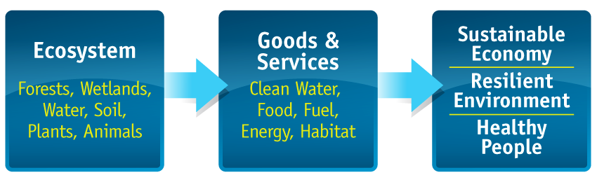
The natural features and ecosystems of the Great Lakes and St. Lawrence River and their watersheds provide important goods and services which we rely on every day. These include things like: drinking water for 80% of Ontarians, economic value from shipping, manufacturing, energy, and agricultural production; they help us to adapt to climate change and provide lots of recreational opportunities which also contribute to our economy and help to keep us healthy.
Coastal Wetlands
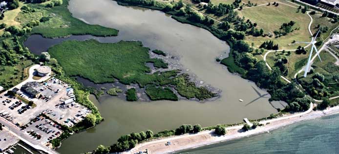
Coastal wetlands such as those found along the shores of the Great Lakes, provide important water and land biodiversity that help protect shoreline areas from storm drainage, control and reduce flooding, improve water quality by filtering out sediments and provide opportunities for recreation.
Not all coastal wetlands are the same. Each one has its own unique set of characteristics and functions.
A common wetland classification scheme used throughout the Great Lakes includes three broad systems, each based on the predominant hydrologic influence on the wetland.
Lacustine Wetlands
Lacustrine Wetlands are predominantly influenced by lake forces, in protected bays or on a stretch of open shoreline.
← Back to Costal Wetlands
Source: Great Lakes Fact Sheet, Government of Canada Publications
Riverine Wetlands
River processes control these wetlands, at river mouths and along major river channels. Examples are all wetlands on the St. Lawrence and St. Clair Rivers, and the many drowned river mouth wetlands on Lake Ontario. Riverine wetlands may be open or protected from the lake.
← Back to Costal Wetlands
Source: Great Lakes Fact Sheet, Government of Canada Publications
Barrier-Protected Wetlands
Barrier-protected wetlands are those that have become physically separated from the Great Lakes by a barrier beach or a series of beach ridges. Barrier beach wetlands are connected to the lake through groundwater and/or periodic channel flow. Many barrier-protected wetlands are found Lake Ontario. Barrier beaches protect many wetlands in the lower lakes, while upper Great Lakes wetlands tend to be more exposed to lake influences due to less sediment accumulation.
← Back to Costal Wetlands
Source: Great Lakes Fact Sheet, Government of Canada Publications
Groundwater
Groundwater is often thought of as an underground river or lake. Actually, groundwater only occurs this way in caves. It is usually stored in areas called aquifers, in small spaces between grains of soil or in cracks in bedrock; much like a sponge holds water. The Niagara Escarpment and the Oak Ridges Moraine are important areas that store groundwater.
Groundwater helps to link the Great Lakes and St. Lawrence River to their watersheds. Water is stored underground and slowly releases to streams, inland lakes and wetlands that eventually flow into our Great Lakes or St. Lawrence River.
Groundwater that flows into streams, rivers and lakes helps sustain the variety of wildlife and plants that depend on our water resources, especially in times of low rainfall. Groundwater occurs, or is recharged, as rain falls onto naturally covered landscapes and soaks deep into the ground. If too much of a landscape is paved over, less rainwater soaks into the ground and the amount of groundwater may decrease.
We are still learning a lot about our groundwater resources. One thing we do know is that once it is contaminated, groundwater is very difficult or even impossible to restore.
Conservation Authorities work with many partners to monitor, report, and protect groundwater resources such as through source protection, stewardship, and watershed management programs.
First Nations
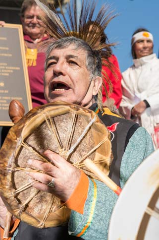
The First Nations people were the first to inhabit the shores of the Great Lakes and fish in its waters. Historically, the Great Lakes were the traditional territories of several large nations, including the Odawa, Ojibway, Chippewa, Mississauga, Oji-Cree, Potawatomi, Menominee, Ho-Chunk, Oneida, Seneca, Iroquois, Mohawk, Huron, among others. In Ontario, the Great Lakes watershed is also an historic location where the Metis identity emerged in Ontario. Currently, there are approximately 75 First Nation communities inhabiting the coasts of the Great Lakes, with many more living within the watershed. All First Nations occupying the Great Lakes Region are engaged in fishing activities to varying degrees.
The First Nations peoples of North America have a special relationship with water. Traditional activities depend on water for transportation, for drinking, cleaning, purification, and water provides habitat for the plants and animals used in traditional medicines and foods. As Indigenous peoples, First Nations recognize the sacredness of water and the interconnectedness of all life.
Source: Assembly of First Nation
Fish
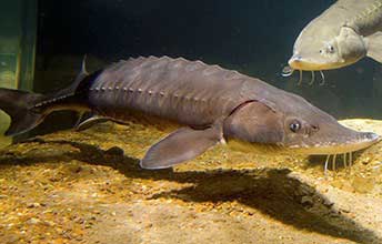
The Great Lakes and St. Lawrence River support a community of approximately 150 native fish species. Humans have also introduced some fish species, both on purpose, as stock for fisheries, and accidently. Native fish species include lake trout, walleye, muskellunge, lake whitefish, yellow perch, and pumpkinseed. Examples of introduced species are the alewife, round goby and some salmon species. The Great Lakes are also home to the largest native fish in North America – the Lake Sturgeon. These fish live long lives; an individual can live over 100 years, growing over 6 feet long and weighing up to 200 lbs!
Many fish eat small aquatic plants and animals within lakes. This helps to control the number of these aquatic plants and animals and keeps our lakes clear and healthy. Fish are also important because they help link our lakes to land. When fish eat small plants or aquatic wildlife and then are eaten themselves by land based animals such as birds, mink and even people, the nutrients within lakes are moved to, and can benefit, land ecosystems. Fish are an important part of the Great Lakes ecosystem, and some species are protected or are being actively restored by people.
Nearshore
Wetlands, beaches, waterfronts and shorelines are where the land meets the lake. These areas closest to shore of the Great Lakes and St. Lawrence River are collectively called the nearshore. The nearshore supports the greatest numbers and highest level of biodiversity out of all areas in the lakes' watersheds.
The nearshore is also the area where people interact with, and can have the greatest impact, both positive and negative, on the lakes. Artificially changing water levels, shoreline hardening, waterfront development, and increased pollution from runoff can all negatively affect the nearshore area and the wildlife within it.
Conservation Authorities help protect our nearshore from these threats by helping cities manage stormwater runoff, designating parks and protected areas, promoting sustainable tourism, and regulating development.
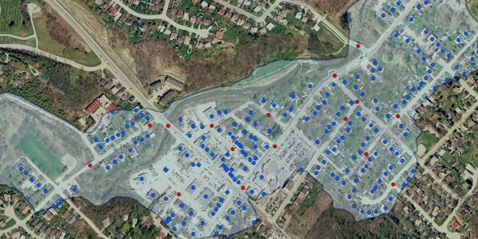
Manmade Features
Whenever we build a road, construct a building, or change the natural landscape we affect how water moves or evaporates.
Manmade features impact how much water travels below and above ground. They change the course of where water moves, how quickly it travels, how much is filtered through natural processes and how many pollutants are taken along with it.
Due to the large population that is congregated in southern Ontario, the land around Lake Ontario has the most paved surfaces. Paying attention to how we develop our cities, towns, and rural areas and incorporating smart, environmentally friendly building practices will help keep the Great Lakes waters, wetlands and land resources healthy and sustainable.
Oak Ridges Moraine
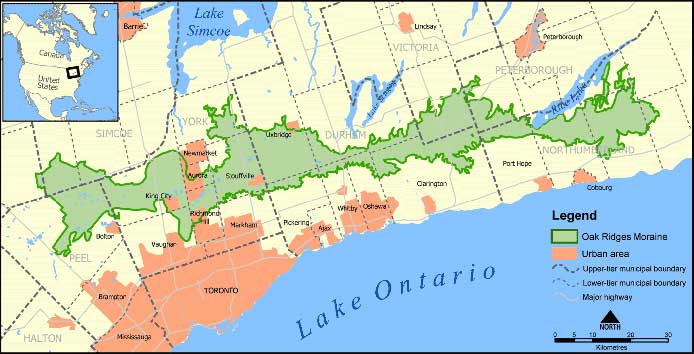
The Oak Ridges Moraine is a landform made up of soil and rock caused by the movement of glaciers over 12,000 years ago.
The Oak Ridges Moraine is extremely important for water resources in Ontario and the Great Lakes and St. Lawrence watersheds. It is often called the rain barrel of Southern Ontario because the soils that make up the moraine have a great capacity to collect and absorb rainfall and snowmelt.
When rainfall and snowmelt are absorbed the groundwater within the moraine is recharged and stored for long periods of time. This groundwater is slowly released into 65 different streams and rivers, all of which flow into the Great Lakes. As the groundwater moves slowly through the moraine's soil it is filtered so that the water entering streams is clean and can support a variety of plants and wildlife. It is important to protect the groundwater within the moraine from overuse and pollution to ensure that clean water continues to flow from the moraine and into our Great Lakes.
Source: Wikimedia.org